
Building-Level Binary Dasymetric Mapping and Spatial-Statistical Analysis of Population Change in Rural Serbia
Article Sidebar
Main Article Content
Abstract
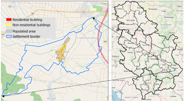
This study primarily implements a building-level Binary Dasymetric Mapping (BDM) framework to analyse population change between 2011 and 2022 in Barje Čiflik, a rural settlement in southeastern Serbia experiencing long-term depopulation. It extends the analysis with spatial and classical statistical methods. High-resolution ancillary data—including manually digitised building footprints, the number of storeys, and building function, all field-verified with abandoned dwellings identified during survey work—were integrated with census counts to allocate population using volume-based weighting.
Population estimates were assigned to each residential building to derive indicators of absolute and relative change, as well as density variation. The analysis combines spatial statistics (Global Moran’s I and Getis–Ord Gi*) with classical statistical techniques (Ordinary Least Squares regression, Spearman’s rank correlation, and LOWESS smoothing) to detect clustering, structural correlates, and spatial patterns of demographic change.
Results show that depopulation is spatially clustered, particularly in peripheral areas of the village, and that larger and multi-storey dwellings are more prone to decline. While density change was modest and statistically dispersed, the study highlights nuanced household-level transformations that remain obscured in aggregated data.
The findings demonstrate that integrating BDM with statistical analysis provides a replicable and cost-effective tool for fine-scale demographic research in rural environments with limited data availability, thereby supporting methodological development and spatial planning.
Article Details
Published by the Institute of Social Sciences - Center for Demographic Research


References
Bajat, B., Hengl, T., Kilibarda, M., & Krunić, N. (2011). Mapping population change index in Southern Serbia (1961–2027) as a function of environmental factors. Computers, Environment and Urban Systems, 35(1), 35–44. https://doi.org/10.1016/j.compenvurbsys.2010.09.005 DOI: https://doi.org/10.1016/j.compenvurbsys.2010.09.005
Bajat, B., Krunić, N., Samardžić Petrović, M., & Kilibarda, M. (2013). Dasimetrično modeliranje dinamike prebivalstva na urbanih območjih. Geodetski vestnik, 57(04), 777–792. https://doi.org/10.15292/geodetski-vestnik.2013.04.777-792 DOI: https://doi.org/10.15292/geodetski-vestnik.2013.04.777-792
Baynes, J., Neale, A., & Hultgren, T. (2022). Improving intelligent dasymetric mapping population density estimates at 30 m resolution for the conterminous United States by excluding uninhabited areas. Earth System Science Data, 14(6), 2833–2849. https://doi.org/10.5194/essd-14-2833-2022 DOI: https://doi.org/10.5194/essd-14-2833-2022
Cartagena-Colón, M., Mattei, H., & Wang, C. (2022). Dasymetric Mapping of Population Using Land Cover Data in JBNERR, Puerto Rico during 1990–2010. Land, 11(12), 2301. https://doi.org/10.3390/land11122301 DOI: https://doi.org/10.3390/land11122301
Chen, Y. (2021). An analytical process of spatial autocorrelation functions based on Moran’s index. PLOS ONE, 16(4), e0249589. https://doi.org/10.1371/journal.pone.0249589 DOI: https://doi.org/10.1371/journal.pone.0249589
Gajić, A., Krunić, N., & Protić, B. (2021). Classification of Rural Areas in Serbia: Framework and Implications for Spatial Planning. Sustainability, 13(4), 1596. https://doi.org/10.3390/su13041596 DOI: https://doi.org/10.3390/su13041596
Gillies, S., van der Wel, C., Van den Bossche, J., Taves, M. W., Arnott, J., Ward, B. C., & others. (2024, July 13). Shapely. Zenodo. https://doi.org/10.5281/ZENODO.5597138
Google. (2020). Google Earth Pro 7.3.3.7786. Geospatial Solutions.
Harris, C. R., Millman, K. J., Van Der Walt, S. J., Gommers, R., Virtanen, P., Cournapeau, D., … Oliphant, T. E. (2020). Array programming with NumPy. Nature, 585(7825), 357–362. https://doi.org/10.1038/s41586-020-2649-2 DOI: https://doi.org/10.1038/s41586-020-2649-2
Hunter, J. D. (2007). Matplotlib: A 2D Graphics Environment. Computing in Science & Engineering, 9(3), 90–95. https://doi.org/10.1109/MCSE.2007.55 DOI: https://doi.org/10.1109/MCSE.2007.55
Jordahl, K., Bossche, J. V. D., Fleischmann, M., Wasserman, J., McBride, J., Gerard, J., … Leblanc, F. (2020, July 15). geopandas/geopandas: v0.8.1. Zenodo. https://doi.org/10.5281/ZENODO.3946761
Krunić, N., Bajat, B., & Kilibarda, M. (2015). Dasymetric Mapping of Population Distribution in Serbia Based on Soil Sealing Degrees Layer. In K. Růžičková & T. Inspektor (Eds), Surface Models for Geosciences (137–149). Cham: Springer International Publishing. https://doi.org/10.1007/978-3-319-18407-4_12 DOI: https://doi.org/10.1007/978-3-319-18407-4_12
Krunic, N., Gajic, A., Srnic, D., & Tosic, D. (2018). Spatial aspects of demographic processes in Serbia. Stanovnistvo, 56(2), 23–38. https://doi.org/10.2298/STNV1802023K DOI: https://doi.org/10.2298/STNV1802023K
Lloyd, C. D. (2010). Spatial data analysis: an introduction for GIS users. Oxford: Oxford university press.
Mennis, J. (2009). Dasymetric Mapping for Estimating Population in Small Areas. Geography Compass, 3(2), 727–745. https://doi.org/10.1111/j.1749-8198.2009.00220.x DOI: https://doi.org/10.1111/j.1749-8198.2009.00220.x
Mennis, J., & Hultgren, T. (2006). Intelligent Dasymetric Mapping and Its Application to Areal Interpolation. Cartography and Geographic Information Science, 33(3), 179–194. https://doi.org/10.1559/152304006779077309 DOI: https://doi.org/10.1559/152304006779077309
OpenStreetMap Contributors. (2017). OpenStreetMap. Planet dump retrieved from https://planet.osm.org. https://www.openstreetmap.org
Ord, J. K., & Getis, A. (1995). Local Spatial Autocorrelation Statistics: Distributional Issues and an Application. Geographical Analysis, 27(4), 286–306. https://doi.org/10.1111/j.1538-4632.1995.tb00912.x DOI: https://doi.org/10.1111/j.1538-4632.1995.tb00912.x
Pajares, E., Muñoz Nieto, R., Meng, L., & Wulfhorst, G. (2021). Population Disaggregation on the Building Level Based on Outdated Census Data. ISPRS International Journal of Geo-Information, 10(10), 662. https://doi.org/10.3390/ijgi10100662 DOI: https://doi.org/10.3390/ijgi10100662
Pirowski, T., & Szypuła, B. (2024). Dasymetric Population Mapping Using Building Data. Annals of the American Association of Geographers, 114(5), 1001–1019. https://doi.org/10.1080/24694452.2024.2313500 DOI: https://doi.org/10.1080/24694452.2024.2313500
QGIS Development Team. (2024). QGIS Geographic Information System. Open Source Geospatial Foundation Project. Open Source Geospatial Foundation. http://qgis.org http://qgis.osgeo.org/ http://qgis.osgeo.org. Accessed 21 March 2024
Rey, S., Anselin, L., Li, X., Pahle, R., Laura, J., Li, W., & Koschinsky, J. (2015). Open Geospatial Analytics with PySAL. ISPRS International Journal of Geo-Information, 4(2), 815–836. https://doi.org/10.3390/ijgi4020815 DOI: https://doi.org/10.3390/ijgi4020815
Seabold, S., & Perktold, J. (2010). Statsmodels: Econometric and Statistical Modeling with Python (92–96). Paper presented at Python in Science Conference, Austin, Texas. https://doi.org/10.25080/Majora-92bf1922-011 DOI: https://doi.org/10.25080/Majora-92bf1922-011
Sheskin, D. J. (2020). Handbook of Parametric and Nonparametric Statistical Procedures (5th edn). Chapman and Hall/CRC. https://doi.org/10.1201/9780429186196 DOI: https://doi.org/10.1201/9780429186196
Statistical Office of the Republic of Serbia. (2024). Number of population in 1948, 1953, 1961, 1971, 1981, 1991, 2002, 2011 and 2022. Belgrade: SORS. https://data.stat.gov.rs/Home/Result/31010101?languageCode=en-US. Accessed 29 May 2025
The pandas development team. (2024, September 20). pandas-dev/pandas: Pandas. Zenodo. https://doi.org/10.5281/ZENODO.3509134
Van Rossum, G., & Drake, F. L. (2009). Python 3 Reference Manual. Scotts Valley, CA: CreateSpace.
Virtanen, P., Gommers, R., Oliphant, T. E., Haberland, M., Reddy, T., Cournapeau, D., … Vázquez-Baeza, Y. (2020). SciPy 1.0: fundamental algorithms for scientific computing in Python. Nature Methods, 17(3), 261–272. https://doi.org/10.1038/s41592-019-0686-2 DOI: https://doi.org/10.1038/s41592-020-0772-5
Wan, H., Yoon, J., Srikrishnan, V., Daniel, B., & Judi, D. (2023). Landscape metrics regularly outperform other traditionally-used ancillary datasets in dasymetric mapping of population. Computers, Environment and Urban Systems, 99, 101899. https://doi.org/10.1016/j.compenvurbsys.2022.101899 DOI: https://doi.org/10.1016/j.compenvurbsys.2022.101899
Waskom, M. (2021). seaborn: statistical data visualization. Journal of Open Source Software, 6(60), 3021. https://doi.org/10.21105/joss.03021 DOI: https://doi.org/10.21105/joss.03021
Wooditch, A., Johnson, N. J., Solymosi, R., Medina Ariza, J., & Langton, S. (2021). Ordinary Least Squares Regression. In A Beginner’s Guide to Statistics for Criminology and Criminal Justice Using R (245–268). Cham: Springer International Publishing. https://doi.org/10.1007/978-3-030-50625-4_15 DOI: https://doi.org/10.1007/978-3-030-50625-4_15
Zandbergen, P. A. (2011). Dasymetric Mapping Using High Resolution Address Point Datasets. Transactions in GIS, 15(s1), 5–27. https://doi.org/10.1111/j.1467-9671.2011.01270.x DOI: https://doi.org/10.1111/j.1467-9671.2011.01270.x